3D LASER SCANNING
Whether you need for a high definition as-built survey - We can help
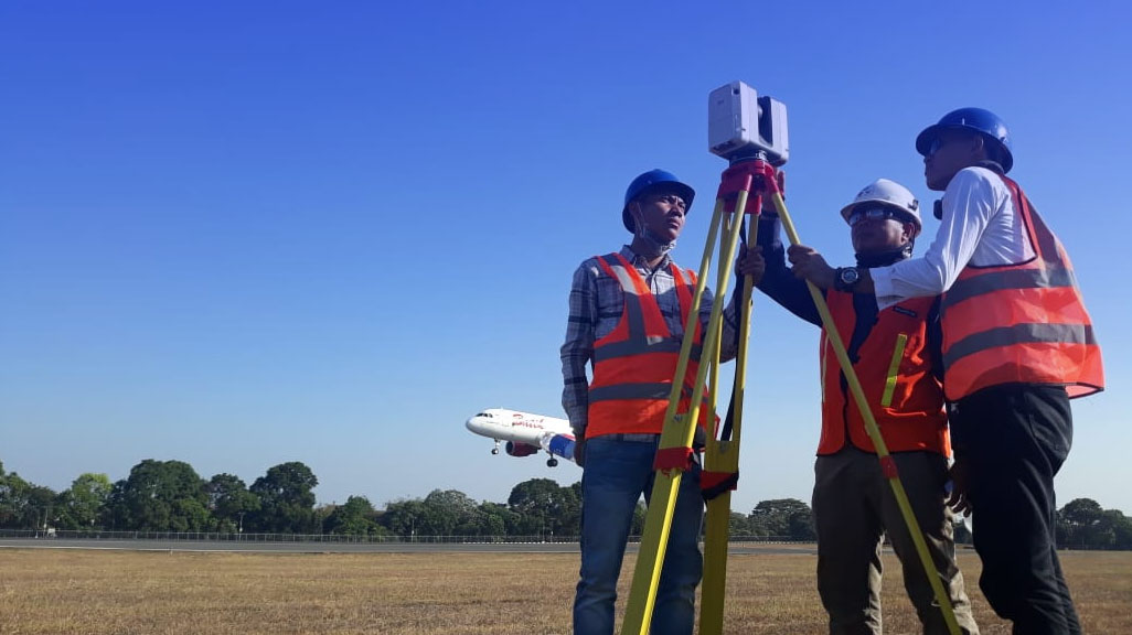
Laser scanning survey is the process of data acquisition by 3D laser scanner devices that will produces 3 (three) dimensional data in point cloud into geometry data presented as millions points and had a x,y,z coordinates on each point. The data point cloud will be converted to a 3 (three) dimensional model and present the actual state of scanned objects, such as piping, building, steel structures, HVAC, land area and the other opened objects above ground. Laser scanner device will be placed at a number of points surrounding of the scanned objects area such as Plant, Refinery, Cement Plant, Pipeline, Offshore Platform,Building. Even laser scanning can be applied for produced As built drawing of site plant, mapping, volume measurement, and asset management.
Output : 3D Modeling, 2D As-built drawings, 3D Modeling Animation, 3D Model Analysis, Volume Measurement, Building Area Size
Benefits of 3D laser scanning
- Fast and high accuracy data capturing, laser scanning able to capturing millions points data per second, reduce a working time for site visit, data requirement will be fast, therefore the construction work will be more effective.
- Enable measuring at dangerous areas or cannot be reached by humans if using manual measurements.
- Safe to be used in dangerous locations such as oil & gas refinery, the laser which used not emitting light and trigger a flame detector.
- Laser Scanning can be executed in live condition, no disturb to machine and humans around them.
- Low Cost and effective time, reduce the personnel cost on survey work, laser scanning is carried out by a few personnel.
Our company is supported by highly experienced staff in using 3D Laser Scanner device and its data processing. Our personnel are comprised of various knowledge disciplines and educational backgrounds such as Civil Engineering, Architecture, Mechanical Engineering, Geodetic, and others that make our company ready to carry out the work that requires a variety of knowledge and knowhow. Our modeling team has a variety of 3D and 2D drawing software required to process point cloud data generated by Laser Scanner.
